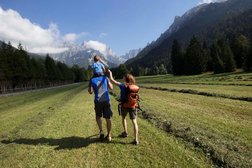


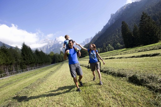
Hikes
Whether it is a simple trail leading to a mountain hut or a route that climbs to the 3192 metres of the highest peak in the Pale di San Martino, hiking at higher altitudes will always be highly rewarding.
It is important to remember that even for the easier itineraries it is always a good idea to have a detailed map of the trails and to wear suitable clothing. Furthermore, we recommend you gather all information on the hike beforehand and you ask the Alpine Guides for any necessary details.
Before undertaking an excursion, it is advisable to consult the weather forecast; however, even if it is favourable, keep in mind that there is a greater probability of thunderstorms in the afternoon and it is thus advisable to set off on a hike early in the morning.
The classic and most popular hikes are those that reach the Alpine mountain huts.
Well sign-posted with red and white CAI-SAT markings, the trails are of varying grades and lengths. It is therefore advisable to find out which itinerary is most suited to one’s training and fitness.
Thanks to the strategic position of our valleys, the Alpine mountain huts are distributed over three mountain ranges: Pale di San Martino, Lagorai range and Feltrine Peaks.
.jpg)
HIKES TO MOUNTAIN HUTS
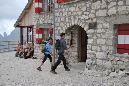
MOUNTAIN HUTS
Colbricon
From Malga Rolle by mule track (signposts No. 14-348): elevation gain 30m, 0.45 hours, easy.
From Passo Rolle by the Cima Cavallazza trail: elevation gain 350m, elevation loss 400m, 3 hours, moderately difficult.
From Malga Ces by trail (signpost No. 14): elevation gain 260m, 2 hours, moderately difficult.
Mulàz (Pale di San Martino)
From Baita Segantini by forest road/trail (signposts No. 721-710):
elevation gain 560m, elevation loss 150 m, 3.30 hours, difficult.
From Malga Venegia by forest road/trail (signposts No. 721-710):
elevation gain 800m, 3.30 hours, difficult.
From Rifugio Pedrotti-Rosetta by equipped trail “Passo delle Farangole”, requires mountain climbing skills.
Pedrotti alla Rosetta (Pale di San Martino)
From the uphill Rosetta cableway station, by trail (signpost No. 701): elevation loss 60 m, 0.20 h, easy.
From Colverde by trail (signpost No. 701): 3.00 hours, demanding.
From San Martino (downhill Colverde cable-car station) by Col dei Bechi trail (signpost No. 702): elevation gain 1100m, 5.00 hours, difficult.
Velo della Madonna (Pale di San Martino)
From San Martino (downhill Colverde cable-car station) by forest road and trail (signposts No. 702-721): elevation gain 900m, 3.30 hours, moderately difficult.
From Malga Zivertaghe by trail (signpost No. 713):
elevation gain 975m, 3.30 hours, moderately difficult.
From Val Canali (Prati Fosne) by equipped trail "Dino Buzzati" (signpost No. 747), requires mountain climbing skills.
From Val Canali (Prati Fosne) by equiped trail "Camillo Depaoli", requires mountain climbing skills.
Pradidali (Pale di San Martino)
From Val Canali (Albergo Baita La Ritonda) by trail (signpost No. 709):
elevation gain 1100m, 3.00 hours, difficult.
From Rifugio Rosetta through Passo Pradidali Basso (signpost No. 709):
elevation gain 200m, elevation loss 400m, 3.30 hours, difficult.
From Rifugio Rosetta by equipped trail “Passo di Ball”, requires mountain climbing skills.
Canali-Treviso (Pale di San Martino)
From Val Canali (Malga Canali) by trail (signpost No. 707):
elevation gain 330m, 1.20 hours, easy.
From Passo Cereda by trail through Forcella d’Oltro (signpost No. 718, Alta Via n.2):
elevation gain 700m, elevation loss 400m, 3.30 hours, difficult.
From Rifugio Pedrotti-Rosetta across the Pale di San Martino plateau and Passo Canali (signposts No. 709-708-707): elevation gain 250m, 6 hours, difficult.
Rifugio Boz (Vette Feltrine)
From Val Noana (near Rifugio Fonteghi) by forest road/trail (signpost No. 727): elevation gain 620m, 2.30 hours, easy.
From Val Noana (near Rifugio Fonteghi) by trail through Col San Piero (signpost No. 748): elevation gain 850m, elevation loss 230m, 3.30 hours, moderately difficult.
Rifugio Vederna (Vette Feltrine)
From Imer (loc. Cappuccetto Rosso) by mule track (signpost No. 736):
elevation gain 700m, 2.00 hours, moderately difficult.
Rifugio Ottone Brentari - Cima d’Asta (Lagorai)
From Caoria (Valle del Vanoi) by the Val Regana trail:
elevation gain 1800m, 5-6 hours, difficult.
RIFUGI ESCURSIONISTICI:
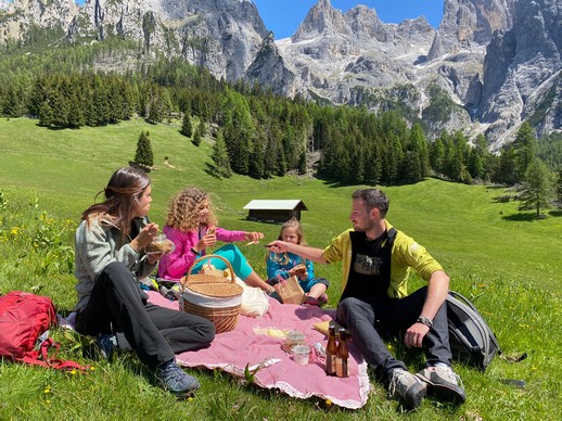
HIKES THROUGH FIELDS AND MEADOWS
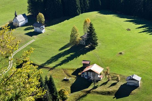
Accessible, easy and suitable for everyone. The hikes through fields and meadows are usually on level ground or with moderate gradients, not demanding and certainly relaxing. This also represents a way to discover mountain-hut architecture, the materials used, the simple yet efficient techniques that have been used for centuries to build masonry stables and casère (mountain dairies) as well as wooden barns.
Prati Castellazzo e Baita Segantini
- From Passo Rolle on dirt road:elevation gain 200m, 1 hour, easy.
- From Malga Fosse by trail (signpost No. 712): elevation gain 240m, 1.30 hours, moderately difficult.
Piani della Cavallazza
- From Malga Fosse by trail (signpost No. 15):elevation gain 100m, elevation loss 60m, 1.30 hours, moderately difficult.
- From Malga Ces by trail (signpost No. 15): elevation gain 300m, 1.30 hours, moderately difficult.
Prati Dismoni
- From Siror on the Piana/Zocaril road (signpost No. 377): elevation gain 550m, 2 hours, easy.
- From San Martino di Castrozza by the Malga Crel forest road (signpost No. 350): elevation gain 130m, elevation loss 250m, 2 hours , easy.
Prati Ronzi
- From San Martino di Castrozza (upper Colverde cable-car station) by forest road (signposts No. 702-724-745): elevation gain 100m, elevation loss 400m, 2 hours, easy.
- From Val Canali (Piereni) on dirt road/trail through the localities of Fosne/Rodena/Prasorin (signposts No. 719-731): elevation gain 250m, elevation loss 100m, 2 hours, moderately difficult.
Prati Fosne - Prà Cimerlo
- From Val Canali (Albergo Baita La Ritonda) by dirt road/mule track across the fields of Cercenadura/Piereni: elevation gain 250m, 2 hours, easy.
Prati Cenquei - Stiozze Ring Route
- From Baita del Vecio by dirt road and trail (signpost No. 723): elevation gain 200m, 2 hours, easy.
Val Giasinozza
- From Rifugio Caltena by dirt road (signpost No. 729): elevation gain 100m, 1.00 hour, easy.
- From Malga Fossetta by trail through Passo Palughét (signpost No. 729): elevation gain 400m, elevation loss 650m, 3.30 hours, difficult.
Prati San Giovanni
- From Rifugio Caltena by dirt road (signpost No. 728): elevation gain 50m, 0.45 hour, easy.
- From Agritur Le Vale farmhouse inn by dirt road (signposts No. 726-728): elevation gain 250m, 1 hour, easy.
- From Mezzano (loc. Oltra) by the Tasedi/Falasorni trail (signpost No. 728): elevation gain 650m, 2.30 hours, facile.
To the Masi del Lozen
- From Zortea, by tarmac road and mule track: elevation gain 150m, 1.30 hour, easy.
Around Colmèi de Ronc
- From Ronco Chiesa, by trails and mule tracks: elevation gain 200m, 2.30 hours, easy
To the remains of Pralongo mining village
- From Canal San Bovo, località Prologo on a convenient mule track: elevation gain 60m, 0.45 hours, facile.
Church of San Silvestro
- From Passo Gobbera on dirt road/trail: elevation gain 150m, 1 hour, easy.
- From Imer (loc. Masi) by trail (signpost No. 346): elevation gain 350m, 1.30 hours, moderately difficult.
HIKES TO LAKES
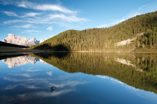
The numerous mountain lakes are excellent destinations for lovely walks and hikes through an unspoilt natural environment.
Lakes of Colbricon
• From Malga Rolle by mule track (signposts No.14-348): elevation gain 30m, 0.45 hours, easy.
• From Passo Rolle by trail through Cima Cavallazza: elevation gain 350m, elevation loss 400m, 3 hours, moderately difficult.
• From Malga Ces by trail (signpost No. 14): elevation gain 260m, 2 hours, moderately difficult.
Lake Calaita
• From San Martino (Campsite area) by forest road/trail (signpost No. 350): elevation gain 210m, 2.30 hours, easy.
• From Rifugio Dismoni by forest road/trail (signposts No. 377-350): elevation gain 410m, 2 hours, moderately difficult.
• From Siror (loc. Nolesca) by trail (signposts No. 351-350): elevation gain 850m, 3 hours, moderately difficult.
Lake Pisorno
• From Lake Calaita by trail (signpost No. 347): elevation gain 500 m, 2.30 hours, moderately difficult.
Lake Welsperg
• From Tonadico (Castelpietra power station) by the “Madonna della Luce” trail: elevation gain 300m, 1 hour, easy.
Lake Noana
• From Val Noana (Rifugio Fonteghi) by dirt road/trail (signpost No. 726): elevation gain 100m, 0.20 hours, easy.
• From Rifugio Caltena by the Poit forest road and the Anconeta trail (signpost No. 726): elevation loss 250m, 1.30 hours, easy.
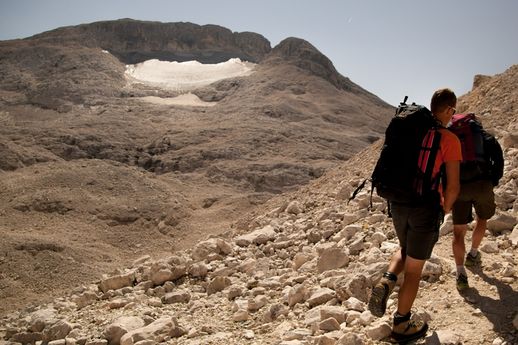
HIKES AT THE MALGHE
.jpg)
On high mountain pastures one often encounters malghe (plural for malga), rustic buildings used to shelter livestock in the summer, and, in the past, to also process milk. Today the milk produced in the malghe is collected every day and taken to the Caseificio di Primiero (Primiero’s Cheese Factory).
Many malgari (herdsmen), no longer engaged in cheese production, have organised in recent years to offer hikers a rustic place to eat.
Malga Civertaghe
• from Hotel Maso Col - Fontanelle area, through path n.23, time 40 minutes;
• from Hotel Maso Col - Fontanelle area, through path n.724 toward Rifugio al Velo AND THEN FOLLOW THE SIGNS FOR MALGA CIVERTAGHE, time 1h30m;
• from Siror through path n.717, time 2 hours;
• from restaurant Cant del Gal - Val Canali through path n.731, time 4 hours.
Difficulty: T
Malga Tognola
• at the arrival of the cableway Tognola, through downhill path 150 metres, 30 mins, difficulty: T
• from San Martino (Camping area) through forest trail/path (trail marker 2-7-8) uphill 700m, 2h30m, difficulty: E
• from San Martino (at the start of cableway Tognola) through forest trail/path (trail marker 352) uphill 750m, 2h30m, difficulty: E
Malga Valcigolera
• from San Martino (Camping area) through forest trail (trail marker 368) uphill 430m, 1h30m, difficulty: T
• from malga Tognola through path (trail marker 9): uphill 260m, 1 hour, difficulty: E
• from refuge Punta Ces through path: downhill 350m, 1 hour, difficulty: E
Malga Crel
• from San Martino (Camping area), through forest trail (trail marker 350): uphill 130m, 1 hour, difficulty: T
Malga Pala
• from San Martino (at the start of cableway Colverde) through path (trail marker 18-701): uphill 510m, 2 hours, difficulty: E
• from San Martino (at the start of cableway Colverde) through ‘Sentiero del Cacciatore’ (trail marker 702-725): uphill 510m, 2h30m, difficulty: E
Malghe Venegia and Venegiota
• from Capanna Cervino through forest trail: 2h30m.
• from Baita Segantini through forest trail: downhill 400m, 2 hours.
• from Pian dei Casoni (Provincial Road of Passo Valles) through forest trail: uphill 120m, 30 minutes.
• from Malga Juribello through path: downhill 100m, 1h30m, difficulty: T
Malga Juribello
• from State Road of Passo Rolle through forest trail: uphill 100m, 1h30m.
• from Passo Rolle (at the start of chairlift Segantini) through path: downhill 50m, 1h30m.
• from Malga Rolle through path/forest trail: downhill 50m, 1h45m.
• from Pian dei Casoni (Provincial Road of Passo Valles) through path: uphill 200m, 2 hours, difficulty: T
Malga Fossetta
• from Passo Cereda through forest trail: uphill 200m, 1 hour, difficulty: T
• from Albergo Baita del Vecio through forest trail (723): uphill 500m, 2 hours, difficulty: E
Malga Canali
• from Val Canali (hotel Cant del Gal) through path of Prati Canali: uphill 150m, 45 minutes, difficulty: T
• from Val Canali (hotel Baita la Ritonda) through path of Malga Pradidali (709): uphill 150m, 1h30m, difficulty: T
Malga Boalon
• from Cicona through forest trail: uphill 700m, 2h30m, difficulty: E
Malga Fiamena
• from Caoria through mule track and forest trail: uphill 900m, 3 hours, medium. In the summer, shuttle bus until Pont de Stel, from there through mule track: uphill 600m, 2 hours, difficulty: E
Malga Fossernica di dentro
• from Rifugio Refavaie through mule track and path 335: uphill 900m, 2 hours, difficulty: E
Malga Fossernica di fuori
• from Caoria, Caseri area through path and military mule track: uphill 900m, 2h30m, difficulty: T
Malga Grugola
• from Lago di Calaita through forest trail: uphill 130m, 45 minutes, difficulty: T
• from Ristorante Lozen through path of Masi al Lozen, Prà del Prete and Malga Lozen: uphill 600m, 1h45m, difficulty: E
CLASSIFICATION OF HIKING DIFFICULTY
Each mountain hike may have different characteristics and difficulties, determined by the nature of the terrain, the type of path, the path exposure, the uphill altitude difference, the maximum height to reach, the season, etc.
To allow you to choose the excursions that you enjoy the most and avoid finding yourself facing higher-than-desired difficulties, there is a special scale which is to be considered approximate, as shown below.
We use the C.A.I. (Italian Alpine Club) acronyms to classify the effort required by the itineraries.
T: Tourist Trail.
Itineraries on small roads, mule tracks or wide paths, with non-long, clear routes that cause no uncertainties or problems with orientation. They require some knowledge of the mountain environment and physical training to walk.
E: Hiking Trail.
Itineraries that take place on paths of all kinds, or on clear passage traces on varied terrain (pastures, debris, or stony ground) with trail markers. They can take place on steep slopes, where, however, the exposed sections are usually protected or secured (cables), they can have single passages or short sections on rocks, not exposed, not tiring nor demanding thanks to the presence of equipment (ladders, rods, cables) that do not require specific gear (harness, carabiners, etc.). They require a sense of orientation, experience and knowledge of the alpine environment, walk training as well as appropriate equipment and footwear.
EE: Trail for Expert Hikers.
They are usually marked itineraries, but require the ability to move on particular terrain. Paths or traces on difficult terrain (steep and/or slippery slopes of grass, or mixed rock and grass, or rock and debris). Varied terrain, even at relatively high altitudes (stony grounds, short, non-steep snowfields, open slopes with no points of reference). Rocky sections, with minor technical difficulties. They require mountain experience in general and adequate physical preparation.
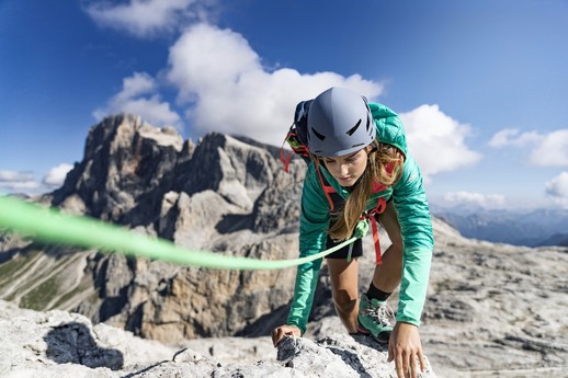
EEA: Trail for Expert Hikers with Equipment.
This acronym indicates equipped trails or climbing routes, in order to inform hikers that the itinerary requires the use of mandatory self-insurance devices (helmet, harness, rope lanyards, carabiners, shock absorbers). These itineraries require mountain experience, good knowledge of the alpine environment, surefootedness, no vertigo, equipment, and adequate physical preparation. It is essential to know how to properly use the self-insurance devices.