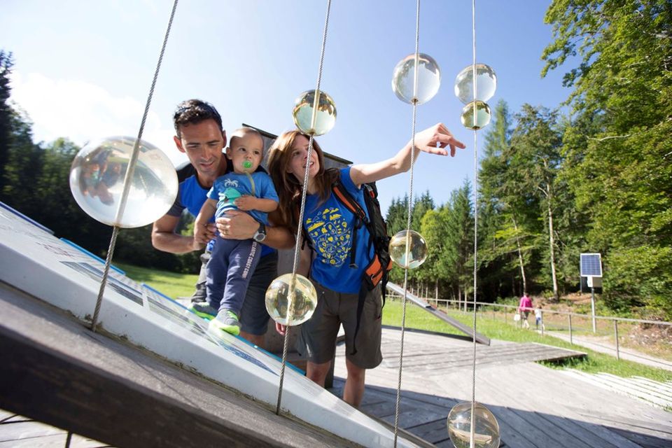


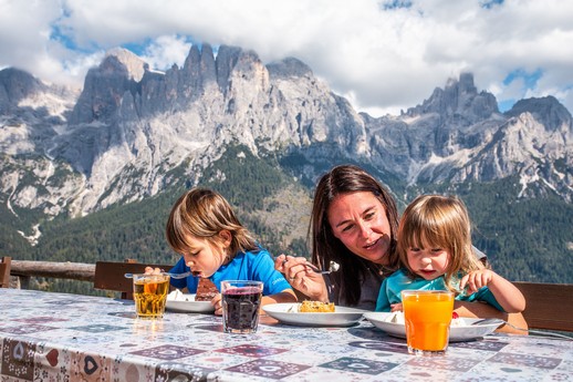
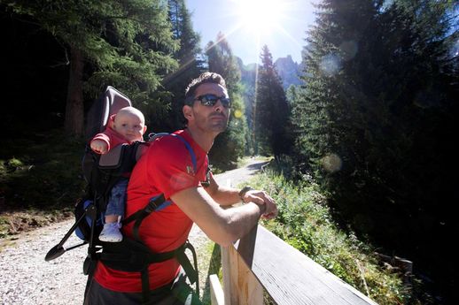
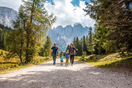
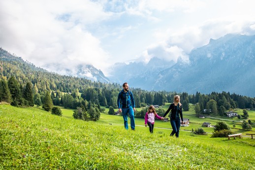
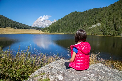
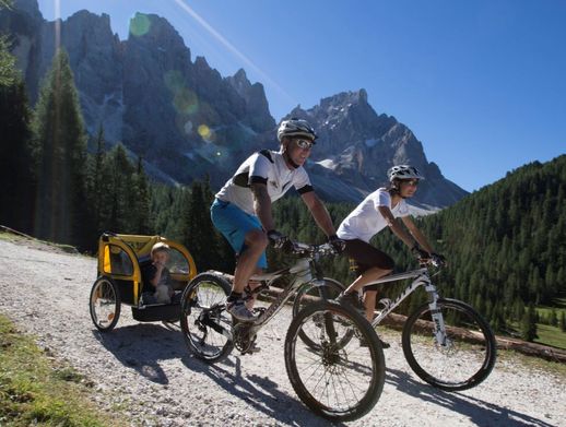
Baby Trekking with Pushchairs
Hiking in the mountains with mum and dad is a proper walk and great fun if you know the right routes!
Here are a few useful suggestions for hiking with very young children, even with a stroller!
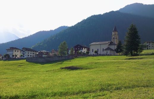
"Sentiero delle marmotte" trail
THE THEMATIC TRAIL WITH A VIEW OF THE PALE DI SAN MARTINO
Departure location: Tognola cable car base station
Parking: at Tognola facilities
Transport used: hiking stroller
Average time: 45 minutes
Difficulty: easy
From San Martino di Castrozza, head towards Fiera di Primiero for about 1 km. On the right, you will find the Tognola cable car station, which has two large parking lots. With the Tognola cable car, you can reach an altitude of 2,200 m in about 10 minutes. From there, a short distance from the Tognola Refuge, you can take the "Sentiero delle Marmotte" Trail. It is a fun thematic trail that allows you to complete a loop with a spectacular view of the Pale di San Martino and the Lagorai mountain range. Afterward, you can return to the starting point and treat yourself to a tasty break at the restaurant, as well as take some family photos on the panoramic terrace.
"Sentiero delle marmotte" Trail is particularly suitable for families and can also be travelled with a hiking stroller, thanks to its comfortable terrain and the presence of wooden walkways that make it easy to cross the marshy sections.
Malga Crel
Departure location: Loc. "Scacciapensieri", San Martino di Castrozza
Parking: Loc. Scacciapensieri
Transport used: hiking stroller
Average time: about 1 hour
Difficulty: easy
The comfortable forest road that starts from the "Scacciapensieri" area in San Martino di Castrozza, not far from the Colbricon Express facility's parking lot, winds its way through a refreshing fir forest.
The itinerary is also suitable for hiking strollers, thanks to the smooth road surface and the slight elevation gain, which mostly occurs in the last few hundred meters leading to Malga Crel. This typical mountain pasture allows you to try local products while admiring the view of the Pale di San Martino surrounded by meadows.
MALGA JURIBELLO
- Starting place: Rolle Pass
- Parking: along the no. 50 Rolle Pass road on the left
- Transport used: hiking pushchair
- Average time: forty minutes
- Difficulty: easy
BAITA SEGANTINI
- Starting place: Rolle Pass
- Parking: along the no. 50 Passo Rolle road near the junction with the forest road for Baita Segantini.
- Transport used: hiking pushchair
- Average time: about one hour and twenty minutes
- Difficulty: medium/difficult
From the direction of San Martino di Castrozza, after leaving your car in the car park located just before the top of the Passo Rolle, the route starts along a pleasant, scenic dirt-track which is uphill at the very beginning. A short distance on, the view opens up and gives you a chance to admire the lovely green meadows. Continuing to the right, you will soon reach the Capanna Cervino (2,084 m). From here, the trail is more challenging, but still easy going for hiking pushchairs with big wheels. The gradient makes it hard work, but by no means impossible. Just take an extra pause or two to catch your breath which you will want to do anyway, so you admire the breath-taking views.It takes just over an hour to get to Baita Segantini (2,200 m), a chalet with an exclusive terrace providing spectacular views over the Pale di San Martino mountains and the famous Cimon peak, known also as the Matterhorn of the Dolomites. Green meadows and a pretty lake complete the idyllic scene. From here, you can take other trails, such as the one down to the equally beautiful Val Venegia or the Cristo Pensante Trail, a solitary, spiritual walk to the top of Mount Castelaz (2,333m-7654ft) which, however, cannot be done with a pushchair, but can be with a baby backpack carrier.In the summer months, there is a paid shuttle service available which links the main Passo Rolle road (from the starting point of the car park) with the Baita Segantini.
VAL VENEGIA
- Starting place: Malga Venegia (1,778m-5833ft)
- Parking: “Pian dei Casoni” (pay and display: € 4 for the entire day)
- Transport used: hiking pushchair
- Average time: one hour and a half hours
- Difficulty: easy
VAL CANALI
IL PERCORSO DELLE MUSE FEDAIE
- Starting place: Val Canali Paneveggio National Park Pale di San Martino
- Parking: Villa Welsperg (pay and display)
- Transport used: pushchair
- Average time: 30 minutes
- Difficulty: easy
A naturalistic, themed hiking trail on foot (from the Villa to Welsperg Lake with no obstacles) - created around Villa Welsperg, in Val Canali.These places are noteworthy from an environmental and scenic point of view. They have a rich bio-diversity which is the common denominator linking the entire “cultural journey” proposed by the National Park. Particular care has been taken over giving visitors the opportunity to observe and internalise, as well as meditate and follow a naturopathic path.This is an itinerary which allows you to discover unexpected corners of the Pale di San Martino mountains, suitable for all the family. The symbolic element used to initially help communicate the basic concept of bio-diversity is Greek mythology, based on the grandiose and mysterious complexity of nature.Hence the title of the project, Muses of Fedaie, where the place name is derived from the word “féda”, meaning sheep. There are seven trail themes: “Norica” horse breeding, the landscape, the vegetation, the land, the “Lamon” breed of sheep, the therapeutic use of water and wet habitats.
SAN MARTINO DI CASTROZZA
ANELLO O PICCOLO
- Starting place: San Martino di Castrozza
- Parking: Prà delle Nasse (free)
- Transport used: pushchair
- Average time: 40 minutes
- Difficulty: easy
Leisurely walk along a dirt-track, ideal for strollers, in a very beautiful natural setting where you can observe the woodland and marshland wildlife in the splendid location of the Pale di San Martino mountains. The trail winds through the lovely pine wood which is an excellent option, even when it is really sunny, as it is for a pleasant stroll at sunset.
ANELLO O GRANDE
.jpg)
- Starting place: San Martino di Castrozza
- Parking: Parking area for the Ces lift system (free)
- Transport used: pushchair
- Average time: 50 minutes
- Difficulty: easy
An easy walk with pushchairs on a dirt-track which winds through a cool pine wood. The view that you are afforded along the path is truly amazing. Halfway along the route, the wood thins out and the view opens onto the Pale di San Martino mountain range. From this panoramic view point, you can learn the names of the peaks of the Dolomite mountains from the handy information signs.
PRIMIERO E DINTORNI
PISTA CICLABILE DI PRIMIERO
- Starting point: Siror
- Arrival point: Imèr
- Brief description: the eleven-kilometre Primiero cycling path follows the course of the river Cismon and crosses the towns of Siror, Tonadico, Fiera di Primiero, Transacqua, Mezzano and Imer, on a route with a variety of road surfaces.
- Length: 11 km in all (Siror- Imer), 1.2 km the Fiera di Primiero – Siror section and 3.8 km the Fiera – Imer section.
- Type of road surface: tarmac
PASSEGGIATA GRISONI-VIGNOLE
.jpg)
- Starting point: Mezzano
- Arrival point: Imèr
- Brief description: easy walk between the two historic town centres, partly along a wide, well-trodden path
- Length: 1 km
- Average walking time: 50’
- Type of road surface: tarmac and dirt-track
- Maps: Primiero2 map (c/o Information office)
The walk starts from the centre of Mezzano, one of the most beautiful villages in Italy, with the two lovely Brolo and Fontana squares which have just been restored and are the settings for a host of events, from the concerts of the Music Academy International of New York to the donkey race for the Palio dei Musati. There are twenty-six artistic wood piles along the route, made from fire wood and the “Tabià del Rico” (Enrico’s barn) with its comprehensive collection of antique artefacts. Once you have crossed the historic town centre along Via di Sopra and Via Grisoni, continue along the path through meadows and vegetable plots towards Imer. Once you are back on the tarmac road again near the cemetery, it is just a short distance to the church of Imer along the bank of the Rio S. Pietro. You cross the historic town centre on long, narrow, cobbled lanes, passing by old barns with arched windows and ancient stone fountains. If you feel like continuing for another twenty minutes, you can take the scenic Via di Sopra walk (dirt-track) from Via Marconi which crosses lovely meadows and orchards to reach the wayside cross of the Madonna del Bus along the Passo Gobbera road.
VIA NOVA
.jpg)
- Starting point: Pieve (Fiera di Primiero)
- Arrival point: Mezzano
- Brief description: one of the classic Primiero walks on an easy path of dirt-track and cobbles which crosses the slopes of mount Bedolè through meadows and woods, just above the towns.
- Length: 3 km
- Average walking time: 1h30
- Type of ground: dirt-track
- Maps: Primiero1 and Primiero2 map (c/o Information office)
From the fine Gothic buildings of Pieve with the church of the head priest and the Palazzo delle Miniere, you cross the characteristic village along Via San Rocco before continuing along the unpaved road (signs for Via Nova). The scenic route crosses the slopes of mount Bedolè, with no steep climbs, through sections of woodland and lovely meadows with stone and wooden chalets. Once you have passed the village of La Dena, you continue down to Molaren and then, return to Pieve along the cycling path before proceeding along Via Nova as far as the crossroads with a fountain. From here, you go downhill to Mezzano on the narrow road to Bagnan (the second) before crossing the bridge over the Val de Stona ford and downhill along the Via delle Scure. At the entrance to the town, there are two imposing works of the Cataste&Canzei on display, the permanent exhibition of art work created from fire wood. “L’aluviòn” and “Montagna In-Canto”.
LA "CAMPAGNA"
- Starting point: Tonadico
- Arrival point: Siror
- Brief description: All on narrow tarmacked roads with very little traffic, this easy, flat path which links the towns of Tonadico and Siror can also be walked in the evening because it is partially lit.
- Length: 2 km
- Average walking time: 1h
- Type of road surface: tarmac
- Maps: Primiero1 map (c/o Information office)
The route starts from the historic centre of Tonadico, an ancient village, described as an “art gallery town” because it has many sixteenth-century and seventeenth-century frescoes on the facades of the buildings created by travelling painters. In addition to these excellent examples of folk art, you should also visit the old Palazzo Scopoli which is now the site of the town hall. Go out of the town along Via Siror, with the little church of San Vittore and its wonderful series of medieval paintings on the hillside above you. There is a row of milking cow barns up on the hill while below, you can see the “Campagna”, once a series of uninterrupted cultivated fields which is now mostly set aside for making hay to feed the cattle in winter. You soon reach Siror which is known for its fountains, especially the octagonal stone fountains in Venetian style. Before arriving back at Tonadico along the low road (Via Lazer), you should take the time to view the sixteenth-century painting of the Virgin Mary, the large wooden bas-reliefs which tell the story of the “Legends of Primiero”, and the murals by Max Gaudenzi in the portico near the town hall. A little further on, you can also admire the large fresco by Riccardo Schweizer, “I sogni di Bancalonga” near the civic centre.
PRATI DEI NAVOI
.jpg)
- Starting point: Fiera di Primiero
- Arrival point: Transacqua
- Brief description: scenic route along narrow tarmacked roads through the lovely fields of Navoi.
- Length: 1 km
- Average walking time: 1h
- Type of road surface: tarmac
- Maps: Primiero1 map (c/o Information office)
The route starts from the sports centre of Fiera di Primiero which has a small playground. Just a little way along the footpath (downhill), you come to a bridge which crosses the river. Ignore the cycling path which follows the course of the Cismon river, and instead follow the little-used, tarmacked road which climbs gently up through the fields. Once past a barn near which horses often graze, the road makes a wide bend and turns back towards the town. We recommend a stop at the Giardini Enrica; cool, shady gardens. The narrow road leads back to the town of Transacqua alongside fields and the occasional dwelling, passing near the bridge of an old mill that has been restored. Once past the historic centre, you go downhill to Piazza San Marco, with its abundant roses and sculptures by Simone Turra. A little further on, the new Green Park gives you the chance to have a rest with an interactive fountain and games for children.
VALLE DEL VANOI
CAORIA - L'ANELLO DELLA VAL
.jpg)
- Starting and arrival point: Caoria Casa del Sentiero Etnografico (House of the Ethnographic Path)
- Parking: near the “Casa del Sentiero Etnografico”
- Transport used: standard pushchair
- Total length: 3.3 km of which 1 km at Caoria de fora and 2.3 km at Caoria de dentre average trip time: approx. 1 hour
- Elevation gain uphill: 110 m
- Type of road surface: paved roads
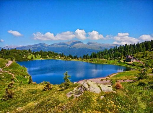
LAGO DI CALAITA
- Starting place: Rifugio Miralago - Lake Calaita
- Parking: car park below the Malga Doch near the Rifugio Miralago (not very big - free)
- Transport used: hiking pushchair
- Trail length: Approx. 3.5 km•Average time: 1 hour
- Difficulty: easy
The starting point is at the Rifugio Miralago (1621m-5318ft) and continues along the unpaved road (trail marked 350) which skirts the lake northwards. The beginning of the trail is a gentle, steady uphill climb which is not too difficult and goes through the sunny meadow of the Malga Doch. In the background, you can admire the wonderful view of the Pale di San Martino mountain range. The road is wide and well-trodden and continues uphill to the end of the meadow where the wood starts and hikers can go on to San Martino di Castrozza or towards the towns of Dismoni and Siror. The return route is along the same path, leaving the Pale mountains behind you and returning to Lake Calaita.This starting point for numerous excursions was formed by a morainic barrier. The banks are low, grassy and peaty; the ageing process is very advanced and the water is very shallow. There are no obvious inlets or outlets and the water supply is from the scree above.Lake Calaita is a great place for both adults and children to enjoy a picnic in the fields, as well as a pleasant lunch at the Rifugio Miralago (1617m-5305ft) or at the Malga Lozen (a few miles from the lake) where you can try some delicious local food.
CANAL SAN BOVO - ANELLO DELL'ACQUA
- Starting place: Canal San Bovo Vanoi Ecomuseum
- Parking: car park in the square nearby
- Transport used: a baby backpack carrier is recommended although a pushchair can be used along the entire route, except for three sections of the trail (a few hundred yards) which are quite steep
- at the beginning and central part of the route.
- Trail length: 3.2 km
- Average time: 1 hour
- Difficulty: medium-easy
An easy walk, suitable for everyone, that winds around and through the town of Canal San Bovo for about 3 km. From the area in front of the Ecomuseum, proceed south-west as far as the Lozen river and then on to where it joins up with the Vanoi river. From here, you circle the course of the Vanoi before heading into the little wood in the north-east. Once you have passed the steps leading up to the artisan area of Canal San Bovo, continue towards the steep path which heads up into another wooded area. You then return to the houses and the starting point via the top of the town.There are fifteen information panels placed along the route which focus on the relationship between man and water in the past and in modern times. There are light blue rosette path markers along the route with an arrow indicating the direction to take.
AS AN ALTERNATIVE TO THE STROLLER
COLBRICON LAKES
- Starting place: Malga Rolle
- Parking: car park below the Agritur Malga Rolle (not very big - free)
- Transport used: baby backpack carrier - NO pushchairs
- Average time: forty minutes
- Difficulty: easy
The starting point is at the Malga Rolle (1918m-6923ft), just past the Rolle Pass, arriving from San Martino di Castrozza. Parking is free, but there are not many spaces.The start of the path is about one hundred metres below the main road near the Chalet la Baita. The beginning of the trail is a gentle, steady uphill climb which is not too difficult, in the middle of a scented wood.The wide, well-trodden mule track (which, however, is not suitable for pushchairs because of all the tree roots and rocky sections) continues uphill until the trees begin to thin out. Here, the first of the two lakes appears on the right (the so-called “low” lake, 1909m-6263ft). Your destination of the lovely plateau with the other lake (1922m-6306ft) and the Rifugio Colbricon (1927m-6322ft) are not far away.The Colbricon lakes are a great place for young children: the perfect location for a picnic in the fields or a pleasant lunch at the Rifugio Colbricon (1927m-6263ft), where you can enjoy some delicious local food.
CANAL SAN BOVO PASSEGGIATA RORE
- Starting place: Centre of Canal San Bovo
- Parking: car park near the town hall
- Transport used: baby backpack carrier - NO pushchairs
- Trail length: 3.2 km
- Average time: 1 hour
- Elevation gain: 150 m
- Difficulty: medium-easy
SENTIERO DELLE ERBE CHE CURANO E DELLE PIANTE CHE PROTEGGONO
- Starting place: Zortea near the parish church
- Parking: car park near the playground
- Transport used: baby backpack carrier - NO pushchairs
- Trail length: 4 km
- Average time: 2 hours
- Elevation gain: 200 m
- Difficulty: medium-easy
Hire your EQUIPMENT
At San Martino:
- San Martino Sport San Martino di Castrozza, via Laghetto, 12 - tel. +39 0439-68095 taufermau@libero.it
- Sport Tisot San Martino di Castrozza, via Passo Rolle 135 - tel. +39 0439-68165 fata@sanmartino.org
- Skisport San Martino di Castrozza, tel. +39 0439-68341 info@noleggiskisport.it
At Fiera di Primiero:
- Gubert Sport (Hiking and standard pushchairs, baby backpack carriers, bike trailers and “via ferrata” equipment) Fiera di Primiero, via Guadagnini 20 tel. +39 0439-762182 gubertsport@hotmail.it
Where to hire bike trailers:
- Skisport San Martino di Castrozza, tel. +39 0439-68341 info@noleggiskisport.it
.jpg)
.jpg)